
Related Images


Download:
| Tiny | 161x128 | View | Download |
| Small | 323x256 | View | Download |
| Medium | 646x512 | View | Download |
| Large | 1293x1024 | View | Download |
| Original | 1718x1360 | View | Download |
This image was acquired from
wikimedia. It was marked as Public Domain or CC0 and is free to use. To verify, go to the source and check the information there.
Looking for more info about this image?
Try a Google Reverse Image Search for it.
Try a Google Reverse Image Search for it.
Keywords from Image Description:
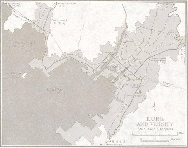
Kure Topographic Maps . ja lib utexas edu Japan AMS Topographic Maps PerryCastaeda Library Map Collection University of Texas Libraries Army Map Service PDUSGov Uploaded with Maps of Hiroshima prefecture Kure Hiroshima Port of Kure