
Related Images


Download:
| Tiny | 198x128 | View | Download |
| Small | 397x256 | View | Download |
| Medium | 794x512 | View | Download |
| Large | 1588x1024 | View | Download |
| Original png | 2172x1400 | View | Download |
| Original as jpg | 2172x1400 | View | Download |
This image was acquired from
wikimedia. It was marked as Public Domain or CC0 and is free to use. To verify, go to the source and check the information there.
Looking for more info about this image?
Try a Google Reverse Image Search for it.
Try a Google Reverse Image Search for it.
Keywords from Image Description:
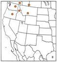
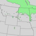
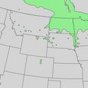
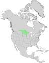
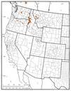
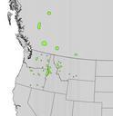
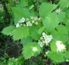
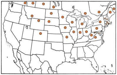
L Map Crataegus chrysocarpa. en Natural distribution map for Crataegus chrysocarpa Atlas of United States trees Vol Supplement Department of Agriculture Miscellaneous Publication maps Elbert Little Jr PDUSGov Uploaded with Crataegus chrysocarpa range maps Flora distribution maps of the United States Crataegus Atlas of United