Related Images


Download:
| Tiny | 196x128 | View | Download |
| Small | 392x256 | View | Download |
| Medium | 784x512 | View | Download |
| Large | 1569x1024 | View | Download |
| Original | 4177x2726 | View | Download |
This image was acquired from
wikimedia. It was marked as Public Domain or CC0 and is free to use. To verify, go to the source and check the information there.
Looking for more info about this image?
Try a Google Reverse Image Search for it.
Try a Google Reverse Image Search for it.
Keywords from Image Description:
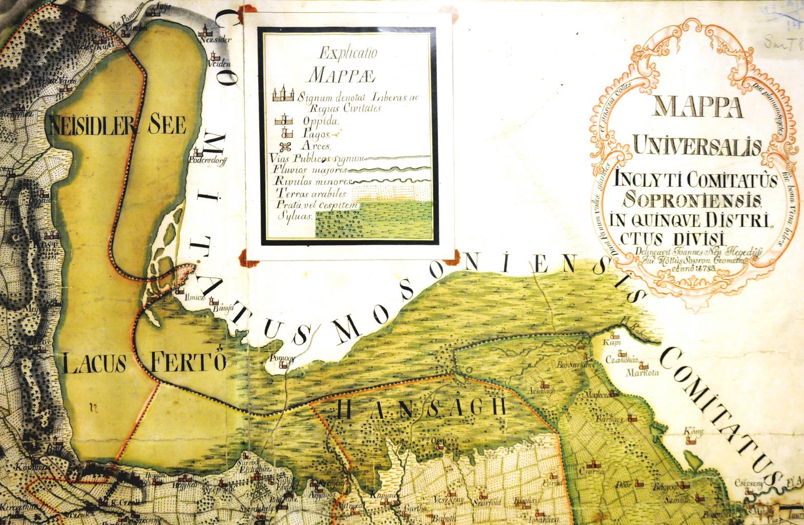
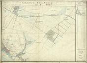
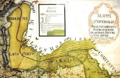
Lake Neusiedl and Hansag . en Map by Johannes Hegeds showing Lake Neusiedl contiguous with the extensive Hansg swamp extending eastward from the southern end of the lake de Karte des Neusiedler Sees mit dem ostwrts vom Sdende des Sees ausgedehnten Sumpfgebiet des Hansg von Johannes Hegeds PDold Glstmedia Maps of Fert Neusiedlersee