
Related Images


Download:
| Tiny | 136x128 | View | Download |
| Small | 273x256 | View | Download |
| Medium | 546x512 | View | Download |
| Original | 599x561 | View | Download |
This image was acquired from
wikimedia. It was marked as Public Domain or CC0 and is free to use. To verify, go to the source and check the information there.
Looking for more info about this image?
Try a Google Reverse Image Search for it.
Try a Google Reverse Image Search for it.
Keywords from Image Description:
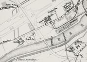
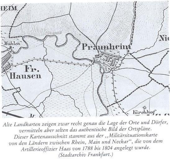
Landkarte etwa aus dem Jahr von Frankfurt Praunheim. en Map from about the year from Frankfurt Praunheim de Landkarte etwa aus dem Jahr von Frankfurt Praunheim Bilder zur Praunheimer Geschichte herausgegeben von der FRaSPa dritte erweiterte auflage Stadtarchiv Frankfurt Main PDold Maps of FrankfurtPraunheim in Frankfurt am