
Related Images


Download:
| Tiny | 200x128 | View | Download |
| Small | 401x256 | View | Download |
| Medium | 802x512 | View | Download |
| Original | 853x544 | View | Download |
This image was acquired from
wikimedia. It was marked as Public Domain or CC0 and is free to use. To verify, go to the source and check the information there.
Looking for more info about this image?
Try a Google Reverse Image Search for it.
Try a Google Reverse Image Search for it.
Keywords from Image Description:
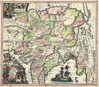
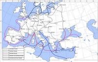
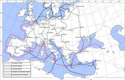
Late Medieval Trade Routes. Map showing the main trade routes of late medieval Europe The black lines show the routes of the Hanseatic League the blue Venetian and the red Genoese routes Purple lines are routes used by both the Venetians and the Genoese Overland and river routes are stippled Own Lampman The map is based on this