
Related Images


Download:
| Tiny | 91x128 | View | Download |
| Small | 183x256 | View | Download |
| Medium | 367x512 | View | Download |
| Large | 734x1024 | View | Download |
| Original | 2310x3222 | View | Download |
This image was acquired from
wikimedia. It was marked as Public Domain or CC0 and is free to use. To verify, go to the source and check the information there.
Looking for more info about this image?
Try a Google Reverse Image Search for it.
Try a Google Reverse Image Search for it.
Keywords from Image Description:
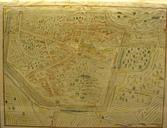
LesBullesCarteHistorique. en An historical map of the village of Les Bulles made in Document modified to make the name visible fr Une carte historique du village de Les Bulles ralise en Carte modifie pour rendre les indications visibles From the Des bles aux Bulles free book about the village info available here foo be author