
Related Images


Download:
| Tiny | 111x128 | View | Download |
| Small | 223x256 | View | Download |
| Medium | 446x512 | View | Download |
| Large | 892x1024 | View | Download |
| Original | 2691x3089 | View | Download |
This image was acquired from
wikimedia. It was marked as Public Domain or CC0 and is free to use. To verify, go to the source and check the information there.
Looking for more info about this image?
Try a Google Reverse Image Search for it.
Try a Google Reverse Image Search for it.
Keywords from Image Description:
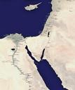
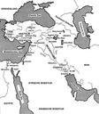
Levant Situeringskaart. Map MiddenOosten eigen bewerking Ben Pirard Maps of the ancient Near East Maps showing history in Dutch Files by User Ben Pirard