
Related Images
Download:
| Tiny | 278x128 | View | Download |
| Small | 557x256 | View | Download |
| Medium | 1115x512 | View | Download |
| Large | 2230x1024 | View | Download |
| Original | 8784x4032 | View | Download |
This image was acquired from
wikimedia. It was marked as Public Domain or CC0 and is free to use. To verify, go to the source and check the information there.
Looking for more info about this image?
Try a Google Reverse Image Search for it.
Try a Google Reverse Image Search for it.
Keywords from Image Description:
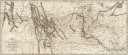
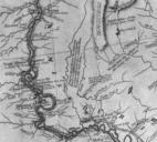
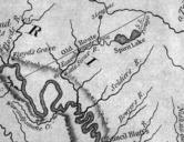
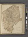
Lewis and Clark track map published LoC. en map of Lewis and Clark's track across the western portion of North America from the Mississippi to the Pacific Ocean in Copied by Samuel Lewis from the original drawing of William Clark Published in Philadelphia in by Bradford and Inskeep Library of Congress Geography Map division