
Related Images


This image was acquired from
wikimedia. It was marked as Public Domain or CC0 and is free to use. To verify, go to the source and check the information there.
Looking for more info about this image?
Try a Google Reverse Image Search for it.
Try a Google Reverse Image Search for it.
Keywords from Image Description:
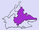
Lingiari division map. Map of the Australian electoral Division of Lingiari The base map is from Image BlankMapWorldSubdivisions the Cocos Keeling Islands and Christmas Island are drawn by me Hoshie The source of boundries of the Divison are from aec gov au pdf this map by the Australian Electoral Commission Hoshie Maps of the