
Related Images


Download:
| Tiny | 169x128 | View | Download |
| Small | 338x256 | View | Download |
| Medium | 676x512 | View | Download |
| Large | 1352x1024 | View | Download |
| Original | 5207x3941 | View | Download |
This image was acquired from
wikimedia. It was marked as Public Domain or CC0 and is free to use. To verify, go to the source and check the information there.
Looking for more info about this image?
Try a Google Reverse Image Search for it.
Try a Google Reverse Image Search for it.
Keywords from Image Description:
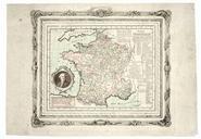
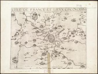
L'Isle de France et lieux circvoysins. Map of the province of L'Isle de France showing the city of Paris and the areas adjacent Appears in Tavernier's Thtre gographique du Royaume de France Paris Scale ca Size cm Institution Boston Public Library object history exhibition history credit line bpl org Norman Leventhal Map