Related Images


Download:
| Tiny | 153x128 | View | Download |
| Small | 307x256 | View | Download |
| Medium | 614x512 | View | Download |
| Large | 1229x1024 | View | Download |
| Original tiff | 6299x5248 | View | Download |
| Original as jpg | 6299x5248 | View | Download |
This image was acquired from
wikimedia. It was marked as Public Domain or CC0 and is free to use. To verify, go to the source and check the information there.
Looking for more info about this image?
Try a Google Reverse Image Search for it.
Try a Google Reverse Image Search for it.
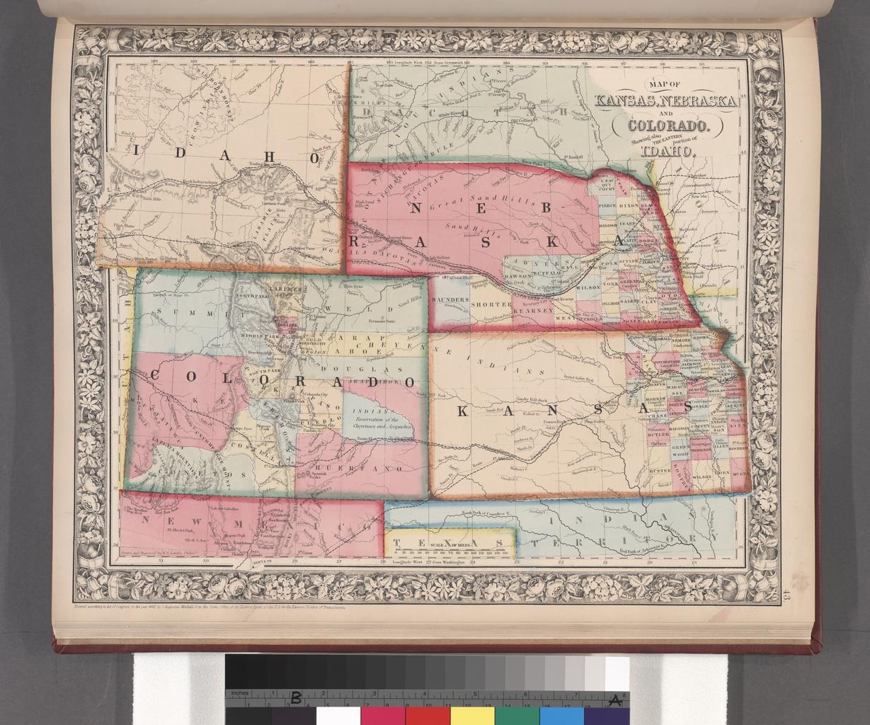
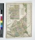
Keywords from Image Description:
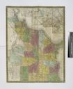
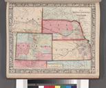
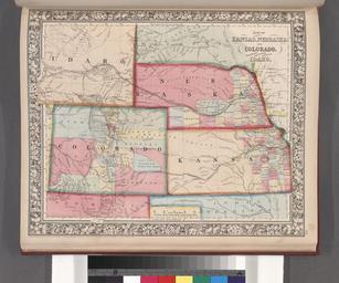
Map of Kansas Nebraska and Colorado. Showing also the eastern portion of Idaho. NYPL. Map of Kansas Nebraska and Colorado Showing also the eastern portion of Idaho Atlases gazetteers guidebooks and other books Mitchell's new general atlas containing maps of the various countries of the world plans of cities etc embraced in fiftythree