
Related Images


Download:
| Tiny | 170x128 | View | Download |
| Small | 341x256 | View | Download |
| Original png | 640x480 | View | Download |
| Original as jpg | 640x480 | View | Download |
This image was acquired from
wikimedia. It was marked as Public Domain or CC0 and is free to use. To verify, go to the source and check the information there.
Looking for more info about this image?
Try a Google Reverse Image Search for it.
Try a Google Reverse Image Search for it.
Keywords from Image Description:
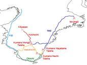
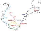
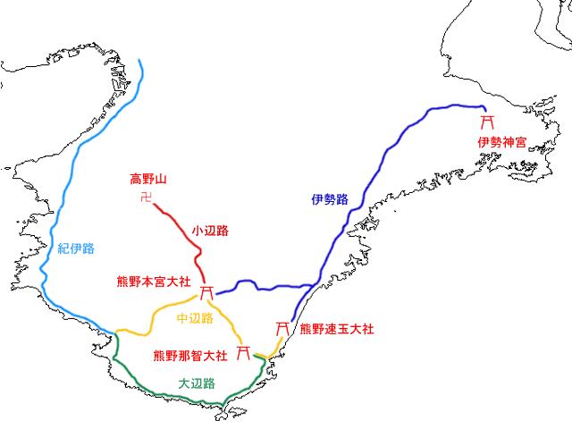
Map Kumano Kodo ja. ja JpLargeMapKinki Map of the old roads of Kumano medieval pilgrimage routes Red icons are shrines and temples that the roads begin and terminate at ja Yosemite ja px Yosemite ja original upload log page ja MapKumanoKodo Yosemite bytes no KumanoNachishrine Tourism in Wakayama prefecture Tourism