Related Images


Download:
| Tiny | 179x128 | View | Download |
| Small | 358x256 | View | Download |
| Medium | 717x512 | View | Download |
| Large | 1435x1024 | View | Download |
| Original tiff | 14430x10290 | View | Download |
| Original as jpg | 14430x10290 | View | Download |
This image was acquired from
wikimedia. It was marked as Public Domain or CC0 and is free to use. To verify, go to the source and check the information there.
Looking for more info about this image?
Try a Google Reverse Image Search for it.
Try a Google Reverse Image Search for it.
Keywords from Image Description:
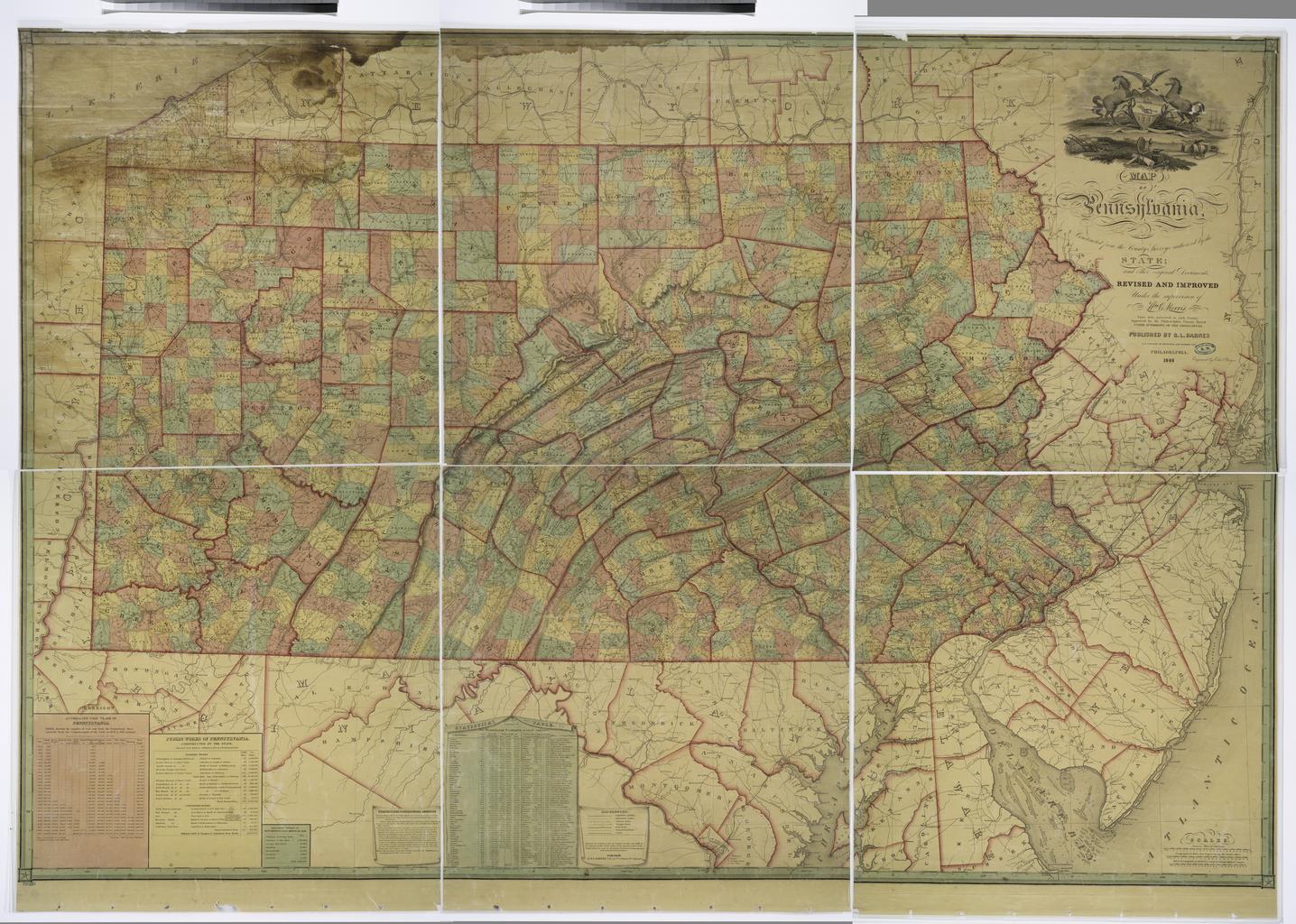
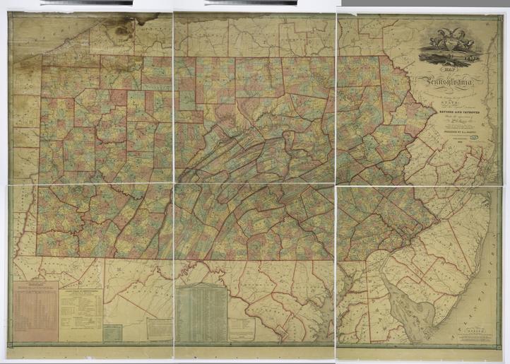
Map of Pennsylvania constructed from the county surveys authorized by the state and other original documents revised and improved under the supervision of Wm. E. Morris civil engineer NYPL. Map of Pennsylvania constructed from the county surveys authorized by the state and other original documents revised and improved under the