
Related Images


Download:
| Tiny | 175x128 | View | Download |
| Small | 350x256 | View | Download |
| Original png | 517x378 | View | Download |
| Original as jpg | 517x378 | View | Download |
This image was acquired from
wikimedia. It was marked as Public Domain or CC0 and is free to use. To verify, go to the source and check the information there.
Looking for more info about this image?
Try a Google Reverse Image Search for it.
Try a Google Reverse Image Search for it.
Keywords from Image Description:
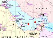
Map Praying Mantis. Map of Persian Gulf marks are approxymate positions of the iranian Oilrigs Sassan left and Sirri right and the city of Bandar Abbas black Both rigs were destroyed while Operation Praying Mantis on April The map is part of Image MiddleEast which is marked as Subject Middle East mapbr Source NIMA nima mil