
Related Images


Download:
| Tiny | 140x128 | View | Download |
| Small | 280x256 | View | Download |
| Medium | 560x512 | View | Download |
| Large | 1121x1024 | View | Download |
| Original | 3219x2938 | View | Download |
This image was acquired from
wikimedia. It was marked as Public Domain or CC0 and is free to use. To verify, go to the source and check the information there.
Looking for more info about this image?
Try a Google Reverse Image Search for it.
Try a Google Reverse Image Search for it.
Keywords from Image Description:
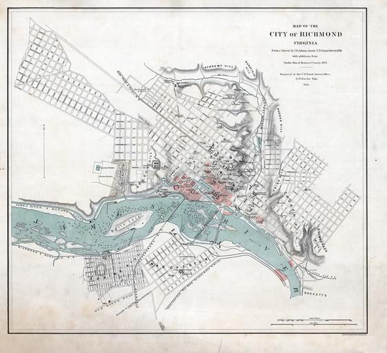
Map of Richmond with burnt districts small. Map of Richmond small Map of the City of Richmond Virginia showing areas red burnt during the Confederate evacuation in From Survey by Adams Assist Coast Survey with additions from Smith's Map of Henrico County Prepared at the Coast Survey Office Bache Supt Scale ca Source for