
Related Images


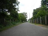
Download:
| Tiny | 178x128 | View | Download |
| Small | 357x256 | View | Download |
| Medium | 714x512 | View | Download |
| Original | 1000x717 | View | Download |
This image was acquired from
wikimedia. It was marked as Public Domain or CC0 and is free to use. To verify, go to the source and check the information there.
Looking for more info about this image?
Try a Google Reverse Image Search for it.
Try a Google Reverse Image Search for it.
Keywords from Image Description:
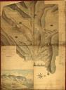
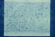
Map of Roads and Cultivated Fields in the Saccam Area . en In the area of Saccam just across the Bay of Tayouan from Fort Zeelandia was the heart of the emerging agricultural colony This map made by the surveyor landmeter and artist Symon Jacobszoon Domckens details the extent of cultivation in the area Image used with permission