Related Images


Download:
| Tiny | 237x128 | View | Download |
| Small | 474x256 | View | Download |
| Medium | 948x512 | View | Download |
| Original png | 1200x648 | View | Download |
| Original as jpg | 1200x648 | View | Download |
This image was acquired from
wikimedia. It was marked as Public Domain or CC0 and is free to use. To verify, go to the source and check the information there.
Looking for more info about this image?
Try a Google Reverse Image Search for it.
Try a Google Reverse Image Search for it.
Keywords from Image Description:
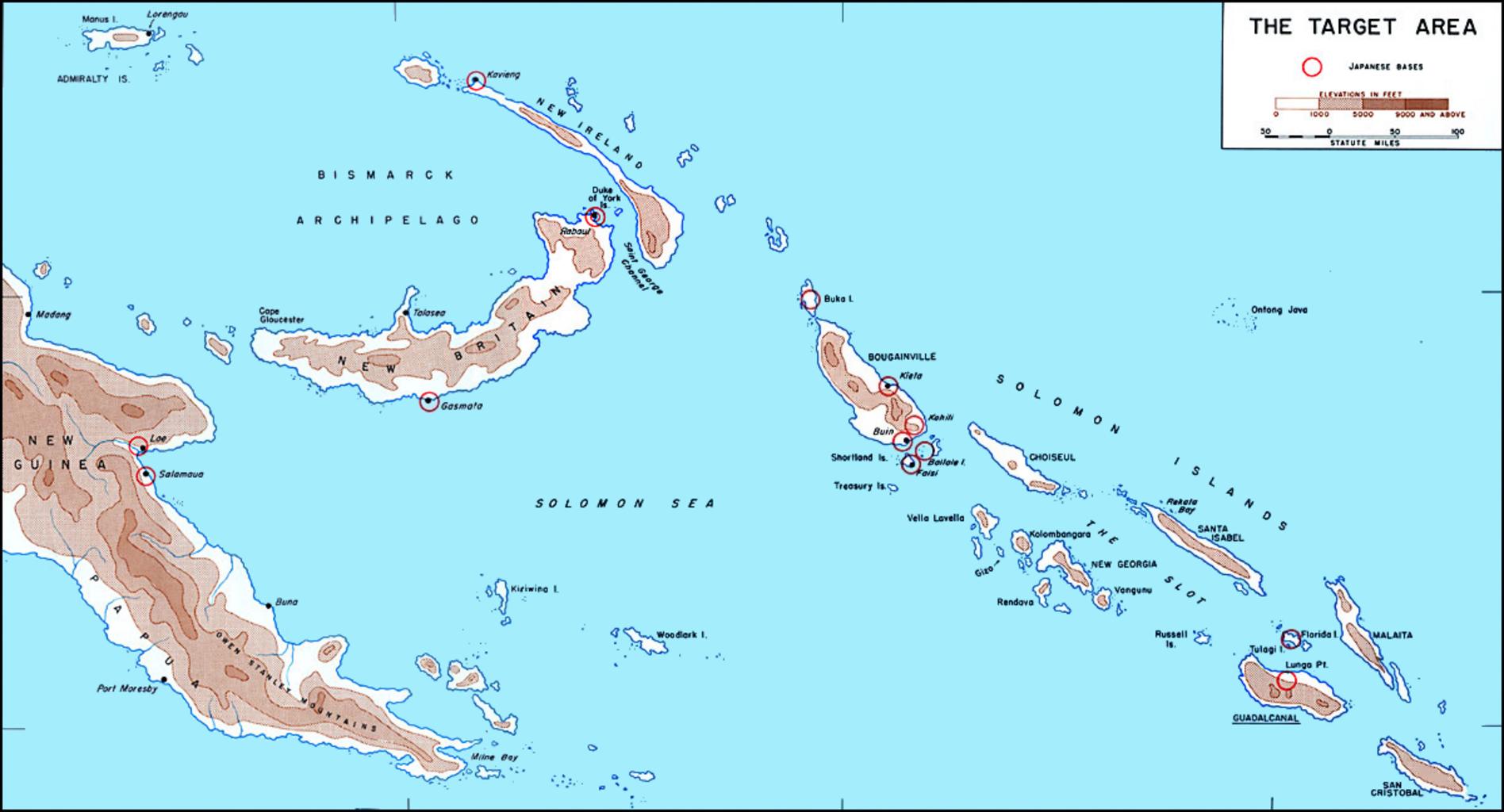
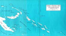
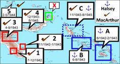
Map of Solomons area in . Map of Solomons area in before invasion of Guadalcanal showing Japanese bases circled in red Image fixed by Angelus talk Angelus talk Angelus talk PDUSGov Other versions it map Solomon Islands Campaign maps Maps of the Solomon Islands Solomon Archipelago