
Related Images


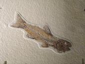
Download:
| Tiny | 164x128 | View | Download |
| Small | 329x256 | View | Download |
| Medium | 659x512 | View | Download |
| Original png | 790x613 | View | Download |
| Original as jpg | 790x613 | View | Download |
This image was acquired from
wikimedia. It was marked as Public Domain or CC0 and is free to use. To verify, go to the source and check the information there.
Looking for more info about this image?
Try a Google Reverse Image Search for it.
Try a Google Reverse Image Search for it.
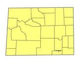
Keywords from Image Description:
Map Wyoming counties USA . Map of Wyoming USA showing county names and boundary lines selfmade using USGS countymap reference image from US Government website water usgs gov March uploaded with labels centered converted to from file of April PDUSGov Usage The map has been purposely labeled with large lettering to be readable