Download:
| Tiny | 182x128 | View | Download |
| Small | 365x256 | View | Download |
| Medium | 731x512 | View | Download |
| Original | 931x652 | View | Download |
This image was acquired from
wikimedia. It was marked as Public Domain or CC0 and is free to use. To verify, go to the source and check the information there.
Looking for more info about this image?
Try a Google Reverse Image Search for it.
Try a Google Reverse Image Search for it.
Keywords from Image Description:
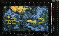
Mapa do SIT So Lus. pt Mapa dos lotes linhas do SIT So Lus sistema de nibus da cidade de So Lus Extrado de saoluis ma gov br pdf No especificado other versions cczero Public transport maps of Brazil Transport in So Lus


