Download:
| Tiny | 193x128 | View | Download |
| Small | 386x256 | View | Download |
| Medium | 773x512 | View | Download |
| Large | 1546x1024 | View | Download |
| Original | 3032x2008 | View | Download |
This image was acquired from
wikimedia. It was marked as Public Domain or CC0 and is free to use. To verify, go to the source and check the information there.
Looking for more info about this image?
Try a Google Reverse Image Search for it.
Try a Google Reverse Image Search for it.
Keywords from Image Description:
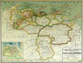
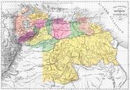
Mapa transporte Merida Venezuela. Mapa de Transporte de la ciudad de Mrida Venezuela Se identifican las principales avenidas de la ciudad as como el terminal regional de autobuses el aeropuerto nacional Hecho por Jorge Paparoni Para uso externo favor indicar fuente autor own assumed Venex Maps of Mrida state


