
Related Images


Download:
| Tiny | 194x128 | View | Download |
| Small | 389x256 | View | Download |
| Medium | 779x512 | View | Download |
| Original | 917x602 | View | Download |
This image was acquired from
wikimedia. It was marked as Public Domain or CC0 and is free to use. To verify, go to the source and check the information there.
Looking for more info about this image?
Try a Google Reverse Image Search for it.
Try a Google Reverse Image Search for it.
Keywords from Image Description:
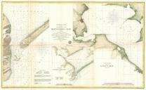
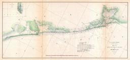
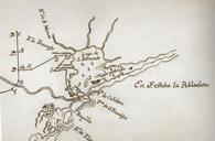
Matagorda Bay Texas . This is map of Matagorda Bay Texas as of The map was drawn by Carlos de Sigenza Gngora based on sketches compiled during the expedition of Alonso de Leon The Spanish called the bay Lago de San Bernardo An marks the spot of the French settlement Fort Saint Louis and Navio Quebrado or broken ship marks the spot