
Related Images


This image was acquired from
wikimedia. It was marked as Public Domain or CC0 and is free to use. To verify, go to the source and check the information there.
Looking for more info about this image?
Try a Google Reverse Image Search for it.
Try a Google Reverse Image Search for it.
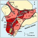
Keywords from Image Description:
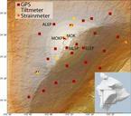
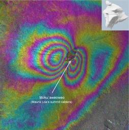
Mauna Loa Summit Inflation InSAR. Mauna Loa as measured by Interferometric synthetic aperture radar wr usgs gov php USGS PDUSGovUSGS Interferometry Geological maps of Hawaii Volcanology Volcano monitoring Inflation volcanism Volcanology in Hawaii Monitoring of Mauna Loa PDUSGov