
Related Images


Download:
| Tiny | 151x128 | View | Download |
| Small | 303x256 | View | Download |
| Original gif | 400x337 | View | Download |
| Original as jpg | 400x337 | View | Download |
This image was acquired from
wikimedia. It was marked as Public Domain or CC0 and is free to use. To verify, go to the source and check the information there.
Looking for more info about this image?
Try a Google Reverse Image Search for it.
Try a Google Reverse Image Search for it.
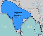
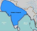
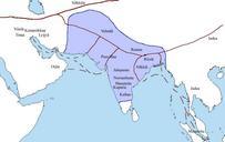
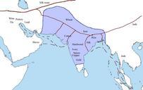
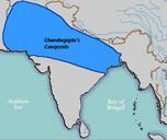
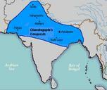
Keywords from Image Description:
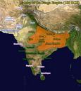
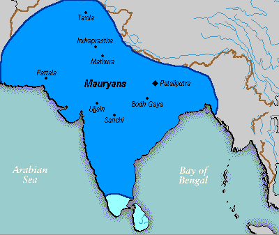
Mauryan Empire Map. historical map en Vastu political map of the Mauryan Empire including notable cities such as the capital Pataliputra and site of the Buddha's enlightenment this mapis really hard to find txd Green blue represents notable rivers black represetns modern political borders and brown represents the border of South