
Related Images


Download:
| Tiny | 181x128 | View | Download |
| Small | 362x256 | View | Download |
| Medium | 724x512 | View | Download |
| Large | 1449x1024 | View | Download |
| Original png | 2550x1801 | View | Download |
| Original as jpg | 2550x1801 | View | Download |
This image was acquired from
wikimedia. It was marked as Public Domain or CC0 and is free to use. To verify, go to the source and check the information there.
Looking for more info about this image?
Try a Google Reverse Image Search for it.
Try a Google Reverse Image Search for it.
Keywords from Image Description:
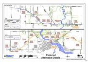
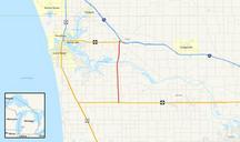
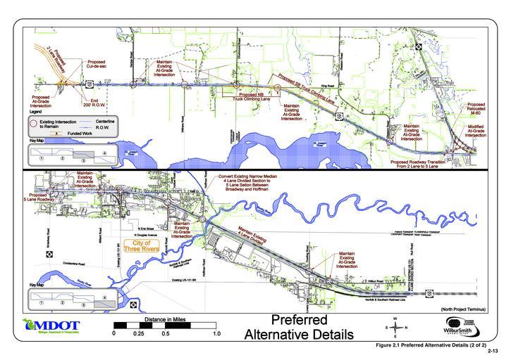
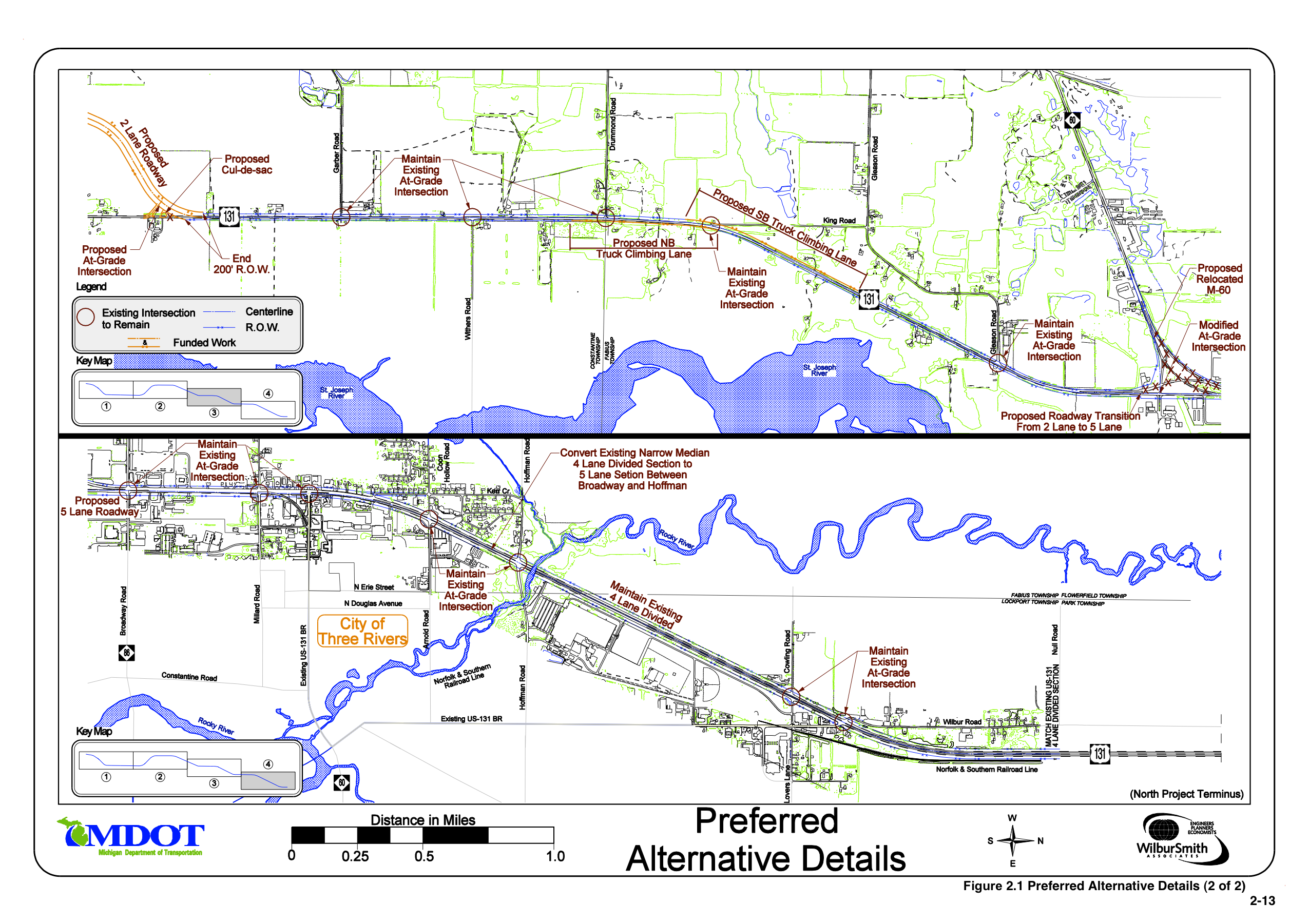
MDOT Constantine Bypass. Planning maps of the proposed bypass of Constantine Michigan along Route These are panels and of panel set illustrating the location of the proposed road and changes to other roadways Note North is to the right Figure Shot from the michigan gov html US Final Environmental Impact Statement and Section