
Related Images


Download:
| Tiny | 120x128 | View | Download |
| Small | 241x256 | View | Download |
| Medium | 482x512 | View | Download |
| Large | 964x1024 | View | Download |
| Original gif | 1450x1540 | View | Download |
| Original as jpg | 1450x1540 | View | Download |
This image was acquired from
wikimedia. It was marked as Public Domain or CC0 and is free to use. To verify, go to the source and check the information there.
Looking for more info about this image?
Try a Google Reverse Image Search for it.
Try a Google Reverse Image Search for it.
Keywords from Image Description:
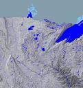
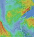
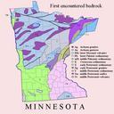
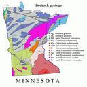
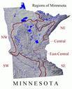
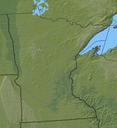
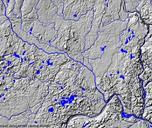
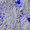
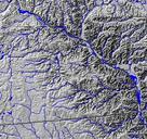
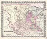
MNTopo. Topographical map of Minnesota in central North America from National Atlas Mapmaker nationalatlas gov asp showing state land and riverine boundaries shaded relief and watercourses Image without borders at Commons at Image MNTopo Geology of Minnesota Geography of Minnesota Maps of Minnesota PDUSGov