Related Images


Download:
| Tiny | 95x128 | View | Download |
| Small | 190x256 | View | Download |
| Medium | 380x512 | View | Download |
| Large | 761x1024 | View | Download |
| Original png | 2021x2717 | View | Download |
| Original as jpg | 2021x2717 | View | Download |
This image was acquired from
wikimedia. It was marked as Public Domain or CC0 and is free to use. To verify, go to the source and check the information there.
Looking for more info about this image?
Try a Google Reverse Image Search for it.
Try a Google Reverse Image Search for it.
Keywords from Image Description:
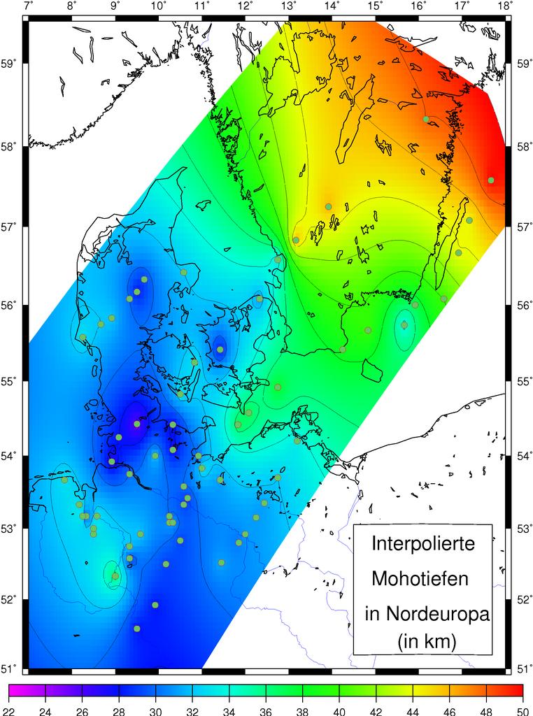
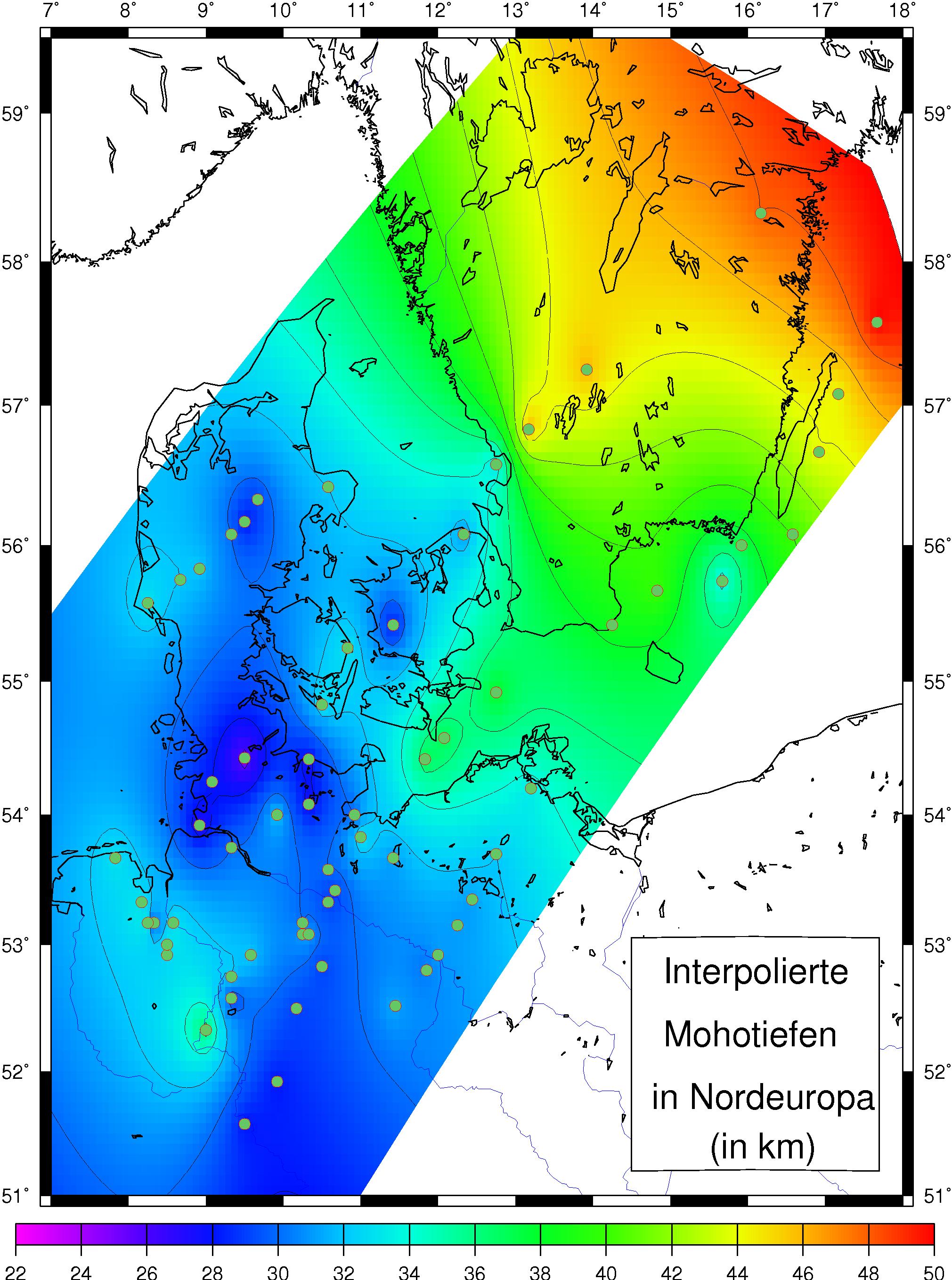
Moho EU. map showing depth to Moho between northern Germany and southern Sweden Karte mit interpolierten Mohotiefen fr Norddeutschland bis Sdschweden own work taken from my diploma thesis modified Ingo Wlbern the author provide this figure to be used in the public domain Check categories February de MohoroviiDiskontinuitt Earth