
Related Images


Download:
| Tiny | 104x128 | View | Download |
| Small | 208x256 | View | Download |
| Medium | 416x512 | View | Download |
| Original png | 724x891 | View | Download |
| Original as jpg | 724x891 | View | Download |
This image was acquired from
wikimedia. It was marked as Public Domain or CC0 and is free to use. To verify, go to the source and check the information there.
Looking for more info about this image?
Try a Google Reverse Image Search for it.
Try a Google Reverse Image Search for it.
Keywords from Image Description:
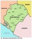
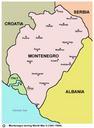
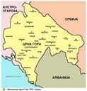
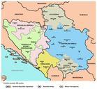
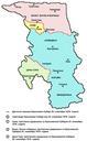
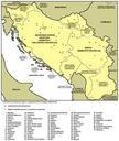
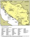
Montenegro map sr. English Map of Montenegro during World War II Serbian Montenegrin language version Serbian Montenegrin Mapa Crne Gore toku Drugog svetskog rata od do godine verzija na srpskom crnogorskom jeziku own PANONIAN Cczero References Borders of Montenegro are primarily based on this source kolski istorijski atlas