
Related Images


Download:
| Tiny | 209x128 | View | Download |
| Small | 419x256 | View | Download |
| Medium | 839x512 | View | Download |
| Original png | 877x535 | View | Download |
| Original as jpg | 877x535 | View | Download |
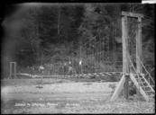
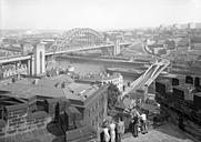
This image was acquired from
wikimedia. It was marked as Public Domain or CC0 and is free to use. To verify, go to the source and check the information there.
Looking for more info about this image?
Try a Google Reverse Image Search for it.
Try a Google Reverse Image Search for it.
Keywords from Image Description:
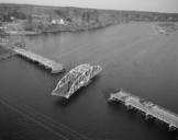
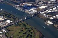
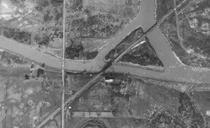
Montrose Swing Bridge aerial photo . en Aerial photo of the Montrose Swing Bridge from One can load up more current image in Google Maps and they will see the development that has taken place in the area USGS Aerial Maps overlay in Google USGS Gov't other versions PDUSGov Uploaded with Railway bridges in Ontario