
Related Images


Download:
| Tiny | 172x128 | View | Download |
| Small | 344x256 | View | Download |
| Medium | 688x512 | View | Download |
| Large | 1377x1024 | View | Download |
| Original | 2097x1559 | View | Download |
This image was acquired from
wikimedia. It was marked as Public Domain or CC0 and is free to use. To verify, go to the source and check the information there.
Looking for more info about this image?
Try a Google Reverse Image Search for it.
Try a Google Reverse Image Search for it.
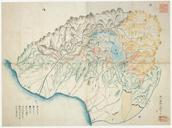
Keywords from Image Description:
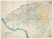
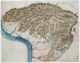
Mt territory map Niikawa . en Illustrated map which separated Mt territory by color of the Niikawa county Etch Province ja The last years of the Edo era PDJapan Old maps of Japan