
Related Images


Download:
| Tiny | 195x128 | View | Download |
| Small | 391x256 | View | Download |
| Medium | 782x512 | View | Download |
| Original | 1280x838 | View | Download |
This image was acquired from
wikimedia. It was marked as Public Domain or CC0 and is free to use. To verify, go to the source and check the information there.
Looking for more info about this image?
Try a Google Reverse Image Search for it.
Try a Google Reverse Image Search for it.
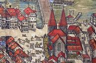
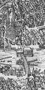
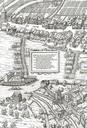
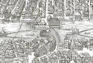
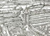
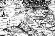
Keywords from Image Description:
Murerplan Wiedikon. Stadt Zrich im Zentrum das heutige Quartier Wiedikon auf der Karte von de Jos Murer aus dem Jahr Zu erkennen sind unter anderem der Uetliberg mit den Burgen Friesenberg und Uetliburg Baldern und Manegg sowie die Stadtquartiere bzw Stadtteile Hard mit dem Hardturm links oben Altstetten St Jakob Aussersihl mit