
Related Images


Download:
| Tiny | 185x128 | View | Download |
| Small | 370x256 | View | Download |
| Medium | 741x512 | View | Download |
| Original | 1225x846 | View | Download |
This image was acquired from
wikimedia. It was marked as Public Domain or CC0 and is free to use. To verify, go to the source and check the information there.
Looking for more info about this image?
Try a Google Reverse Image Search for it.
Try a Google Reverse Image Search for it.
Keywords from Image Description:
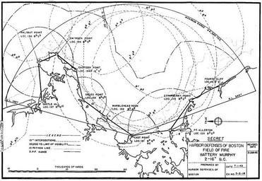
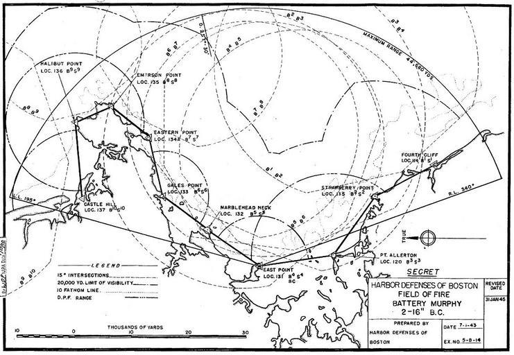
MurphyFOF. This map from the Army Engineers' Annex to the Report on the Harbor Defenses of Boston locates the fire control towers and cottages that made up the network of base end and spotting stations for Battery Murphy the twin inch guns at East Point in Nahant MA Note that this map is oriented with east at the top of the page