
Related Images


Download:
| Tiny | 181x128 | View | Download |
| Small | 363x256 | View | Download |
| Original png | 502x354 | View | Download |
| Original as jpg | 502x354 | View | Download |
This image was acquired from
wikimedia. It was marked as Public Domain or CC0 and is free to use. To verify, go to the source and check the information there.
Looking for more info about this image?
Try a Google Reverse Image Search for it.
Try a Google Reverse Image Search for it.
Keywords from Image Description:
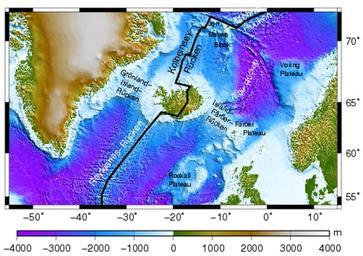
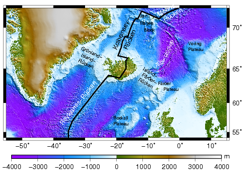
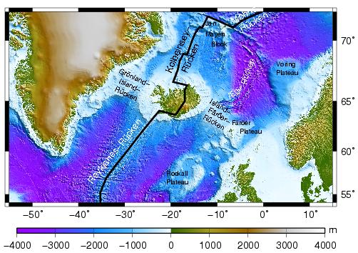
NAtlantictopo de. Topographie des Nordatlantik um Island basierend auf dem GTOPODatensatz Selbst erstellt mit GMT TomR de File NAtlantictopo TomR Original upload log de Jutta CommonsHelper page de NAtlantictopo TomR bytes no Topographie des Nordatlantik um Island basierend auf dem GTOPODatensatz Quelle selbst erstellt