Related Images


Download:
| Tiny | 98x128 | View | Download |
| Small | 197x256 | View | Download |
| Medium | 394x512 | View | Download |
| Large | 788x1024 | View | Download |
| Original png | 1625x2109 | View | Download |
| Original as jpg | 1625x2109 | View | Download |
This image was acquired from
wikimedia. It was marked as Public Domain or CC0 and is free to use. To verify, go to the source and check the information there.
Looking for more info about this image?
Try a Google Reverse Image Search for it.
Try a Google Reverse Image Search for it.
Keywords from Image Description:
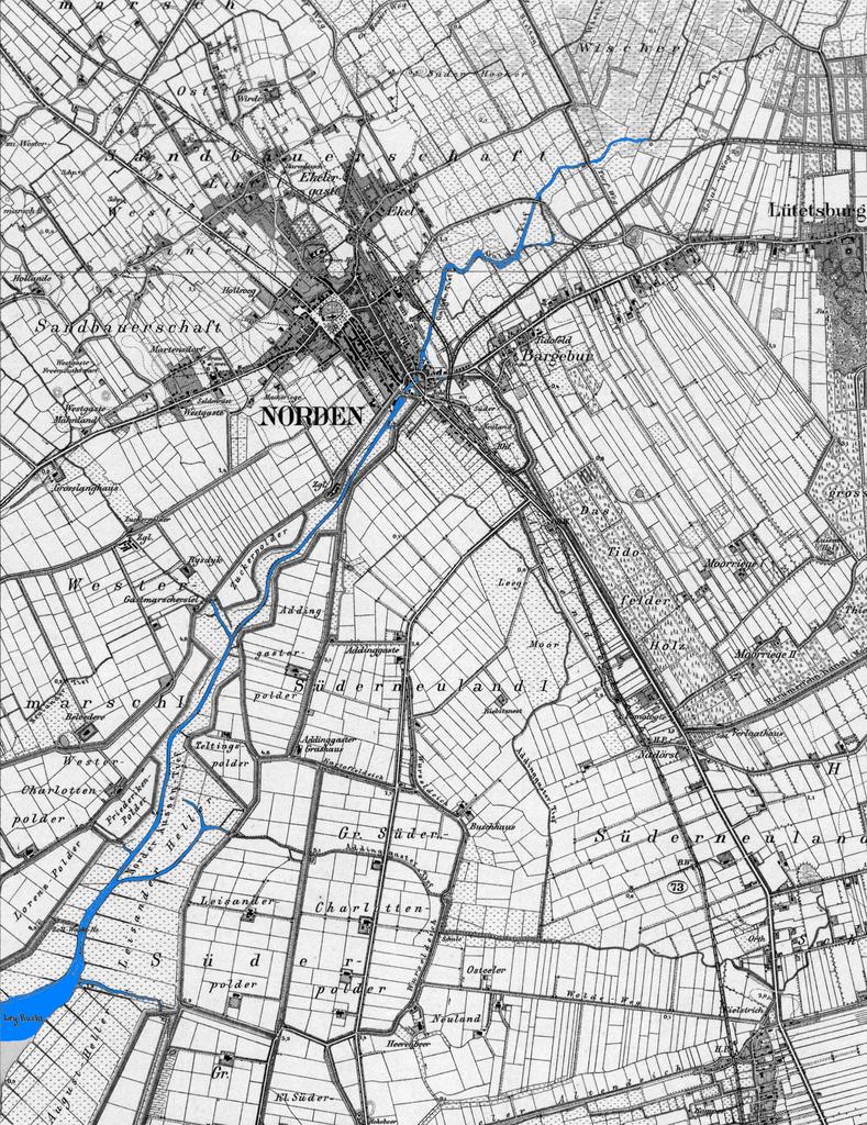
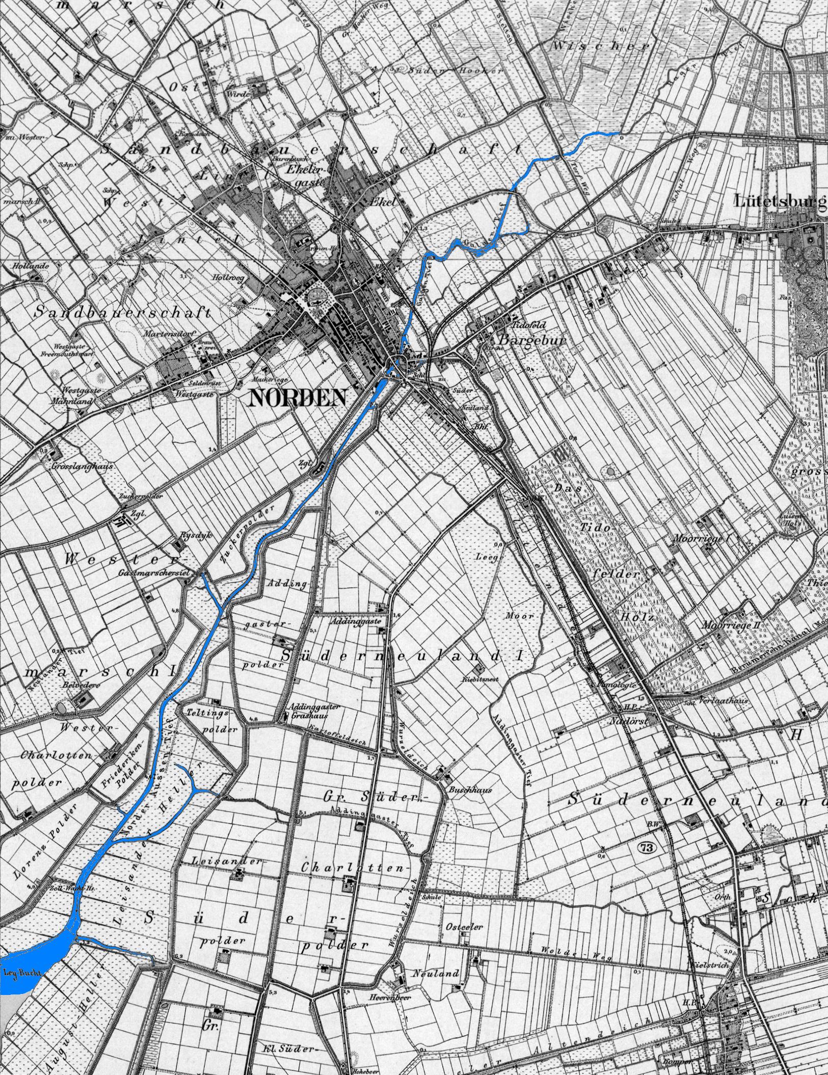
Norder Tief um . Norder Tief Zusammenschnitt aus den Messtischblttern Nr Hage von und Nr Norden von selber nachkoloriert unigreifswald de sft map suchen printed in screenshot upload author Old maps of Lower Saxony Maps made in the th century Maps of rivers of Germany PDold