
Related Images


Download:
| Tiny | 192x128 | View | Download |
| Small | 384x256 | View | Download |
| Medium | 768x512 | View | Download |
| Large | 1536x1024 | View | Download |
| Original | 3300x2200 | View | Download |
This image was acquired from
wikimedia. It was marked as Public Domain or CC0 and is free to use. To verify, go to the source and check the information there.
Looking for more info about this image?
Try a Google Reverse Image Search for it.
Try a Google Reverse Image Search for it.
Keywords from Image Description:
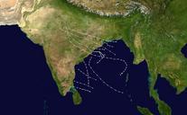
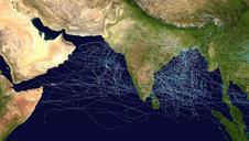
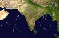
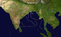
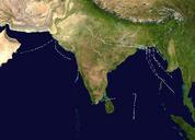
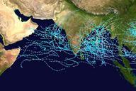
North Indian Ocean cyclone tracks . This map shows the tracks of all tropical cyclones monitored by the Joint Typhoon Warning Center in the North Indian Ocean from to The points show the locations of each storm at sixhour intervals The colour represents the storm's maximum sustained wind speeds as classified in the SaffirSimpson