
Related Images


Download:
| Tiny | 111x128 | View | Download |
| Small | 222x256 | View | Download |
| Medium | 445x512 | View | Download |
| Large | 890x1024 | View | Download |
| Original | 1239x1425 | View | Download |
This image was acquired from
wikimedia. It was marked as Public Domain or CC0 and is free to use. To verify, go to the source and check the information there.
Looking for more info about this image?
Try a Google Reverse Image Search for it.
Try a Google Reverse Image Search for it.
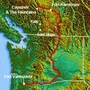
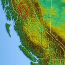
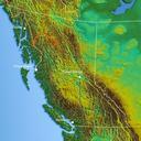
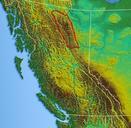
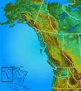
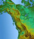
Keywords from Image Description:
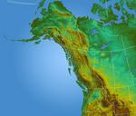
Northwestrelief. Shaded Relief map of Pacific northwest USGS GIS data processed with GIS program reassambled in photoshop Qyd All Topographic maps of British Columbia PDUSGovUSGS