
Related Images


Download:
| Tiny | 87x128 | View | Download |
| Small | 174x256 | View | Download |
| Medium | 348x512 | View | Download |
| Large | 697x1024 | View | Download |
| Original png | 1152x1692 | View | Download |
| Original as jpg | 1152x1692 | View | Download |
This image was acquired from
wikimedia. It was marked as Public Domain or CC0 and is free to use. To verify, go to the source and check the information there.
Looking for more info about this image?
Try a Google Reverse Image Search for it.
Try a Google Reverse Image Search for it.
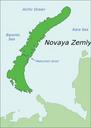
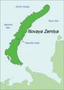
Keywords from Image Description:
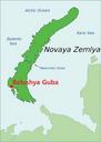
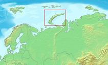
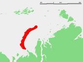
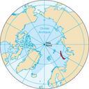
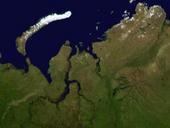
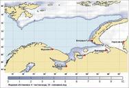
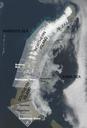
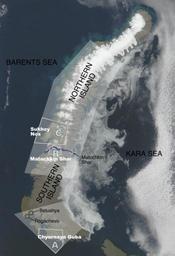
Novaya Zemlya testing map. map of Novaya Zemlya with chief zones of nuclear testing activity indicated with their respective geographical names as well as the general boundaries of the testing subareas on the islands Other geographic details are also indicated Matochkin Shar is the straight which separates the two islands and the