
Related Images


Download:
| Tiny | 149x128 | View | Download |
| Small | 298x256 | View | Download |
| Original gif | 550x471 | View | Download |
| Original as jpg | 550x471 | View | Download |
This image was acquired from
wikimedia. It was marked as Public Domain or CC0 and is free to use. To verify, go to the source and check the information there.
Looking for more info about this image?
Try a Google Reverse Image Search for it.
Try a Google Reverse Image Search for it.
Keywords from Image Description:
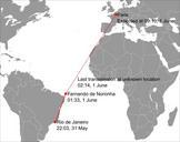
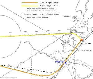
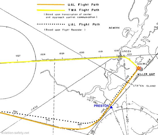
NYAirDisasterMap. Flight paths of planes in NY air disaster NYAirDisasterMapvector svg Civil Aeronautics Board US Government PDUSGov Original upload log page en NYAirDisasterMap Upload date User Bytes Dimensions Comment DragonflyDC no Flight paths of planes in NY air disaster Civil Aeronautics Board US Government Air disasters