
Related Images


Download:
| Tiny | 217x128 | View | Download |
| Small | 435x256 | View | Download |
| Medium | 871x512 | View | Download |
| Original svg | 1006x591 | View | Download |
| Original as jpg | 1006x591 | View | Download |
This image was acquired from
wikimedia. It was marked as Public Domain or CC0 and is free to use. To verify, go to the source and check the information there.
Looking for more info about this image?
Try a Google Reverse Image Search for it.
Try a Google Reverse Image Search for it.
Keywords from Image Description:
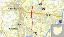
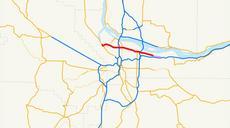
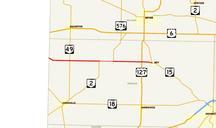
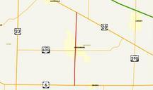
OH Bypass map alternate colors.svg Map of Ohio State Route Bypass with alternate coloring based on potential standards mentioned here Explicitly in public domain so that anyone may upload new versions as new standards evolve own data from census gov Census Bureau inkscape Mr Matt Explicitly released into public domain for any