Download:
| Tiny | 138x128 | View | Download |
| Original svg | 151x140 | View | Download |
| Original as jpg | 151x140 | View | Download |
This image was acquired from
wikimedia. It was marked as Public Domain or CC0 and is free to use. To verify, go to the source and check the information there.
Looking for more info about this image?
Try a Google Reverse Image Search for it.
Try a Google Reverse Image Search for it.
Keywords from Image Description:
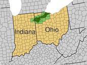
Ohio and adjacent States and counties with FIPS and names.svg blank map of Ohio and adjacent state's counties Every county's object in this SVG has its FIPS code in the object id field with the county name and letter postal state abbreviation in the label field In cases where there is county in state that also has countyequivalent

