
Related Images


Download:
| Tiny | 82x128 | View | Download |
| Small | 164x256 | View | Download |
| Medium | 328x512 | View | Download |
| Large | 657x1024 | View | Download |
| Original | 1579x2461 | View | Download |
This image was acquired from
wikimedia. It was marked as Public Domain or CC0 and is free to use. To verify, go to the source and check the information there.
Looking for more info about this image?
Try a Google Reverse Image Search for it.
Try a Google Reverse Image Search for it.
Keywords from Image Description:
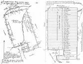
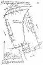
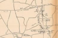
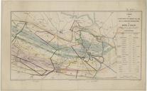
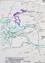
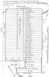
Old Mines concession plat survey. Old Mines land concession with the original owners of each plot shown by surveyor Thomas Maddin Schroeder Walter Opening the Ozarks Historical Geography of Missouri's Ste Genevieve District Thomas Maddin surveyor PDOld Old Mines Missouri