
Related Images


Download:
| Tiny | 80x128 | View | Download |
| Small | 161x256 | View | Download |
| Medium | 322x512 | View | Download |
| Large | 645x1024 | View | Download |
| Original gif | 1433x2273 | View | Download |
| Original as jpg | 1433x2273 | View | Download |
This image was acquired from
wikimedia. It was marked as Public Domain or CC0 and is free to use. To verify, go to the source and check the information there.
Looking for more info about this image?
Try a Google Reverse Image Search for it.
Try a Google Reverse Image Search for it.
Keywords from Image Description:
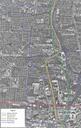
Olentangy West Aerial Photo and Map. en United States Geological Survey Aerial Photo with self made map added own Analogue Kid cczero Uploaded with Columbus Ohio metropolitan area