Related Images


Download:
| Tiny | 172x128 | View | Download |
| Small | 345x256 | View | Download |
| Original png | 428x317 | View | Download |
| Original as jpg | 428x317 | View | Download |
This image was acquired from
wikimedia. It was marked as Public Domain or CC0 and is free to use. To verify, go to the source and check the information there.
Looking for more info about this image?
Try a Google Reverse Image Search for it.
Try a Google Reverse Image Search for it.
Keywords from Image Description:
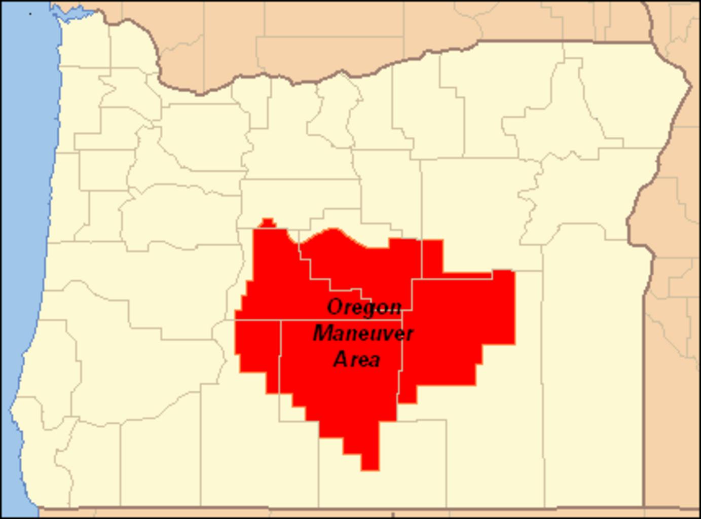
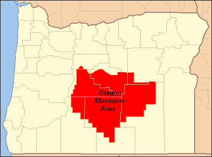
Oregon Maneuver Area . en Map showing the area used by the United States Army for the Oregon Maneuver World War II training exercise conducted in central Oregon in the maneuver area covers much of Crook Deschutes Harney Klamath and Lake counties plus small parts of Jefferson and Grant counties created this work myself using as map