Related Images


Download:
| Tiny | 91x128 | View | Download |
| Small | 182x256 | View | Download |
| Medium | 365x512 | View | Download |
| Large | 731x1024 | View | Download |
| Original | 1439x2014 | View | Download |
This image was acquired from
wikimedia. It was marked as Public Domain or CC0 and is free to use. To verify, go to the source and check the information there.
Looking for more info about this image?
Try a Google Reverse Image Search for it.
Try a Google Reverse Image Search for it.
Keywords from Image Description:
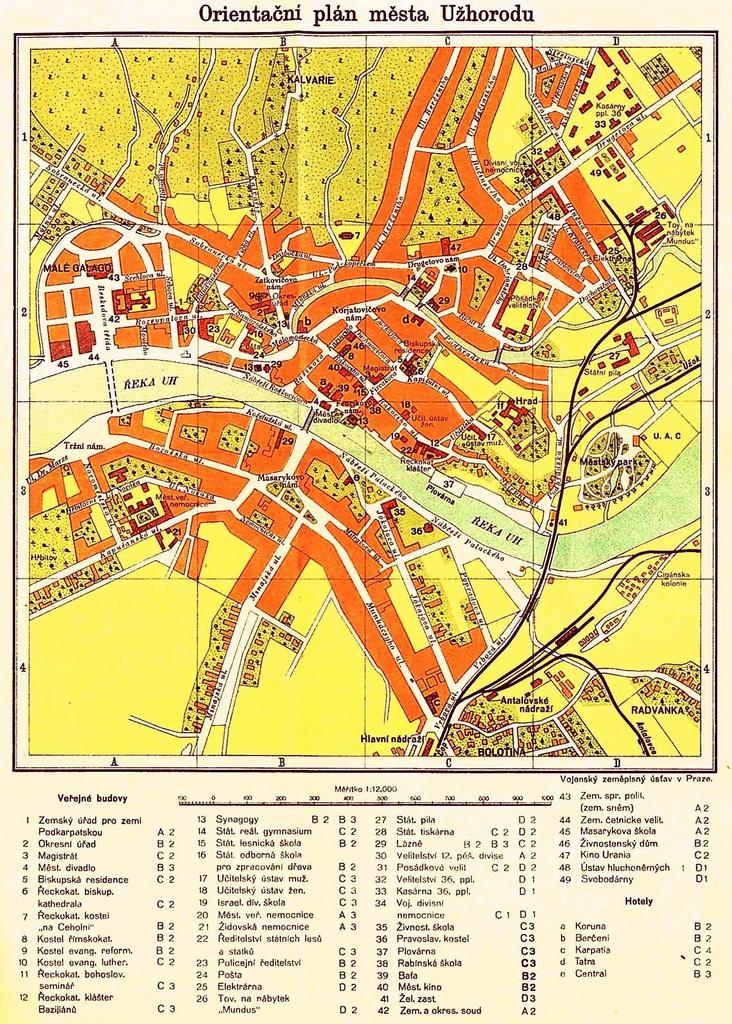
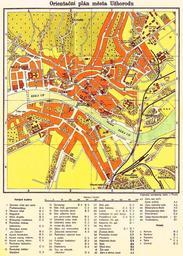
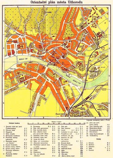
Orientan pln msta Uhorodu. are in Czech Publication Prvodce po eskoslovensku st Zem Slovensk Podkarpatorusk third edition published by publishing house Orbis in Prague Vojensk zempisn stav Praze PDArt Maps of Czechoslovakia Geography of Uzhhorod Maps in Czech maps Old maps of cities in Ukraine