
Related Images

Download:
| Tiny | 201x128 | View | Download |
| Small | 402x256 | View | Download |
| Medium | 804x512 | View | Download |
| Original svg | 1100x700 | View | Download |
| Original as jpg | 1100x700 | View | Download |
This image was acquired from
wikimedia. It was marked as Public Domain or CC0 and is free to use. To verify, go to the source and check the information there.
Looking for more info about this image?
Try a Google Reverse Image Search for it.
Try a Google Reverse Image Search for it.
Keywords from Image Description:
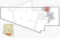
Pima County Incorporated and Unincorporated areas Tortolita highlighted.svg This map shows the incorporated areas and unincorporated areas in Pima County Arizona Incorporated cities are shown in gray and data for their borders and locations are based on the pagnet org htm Title Travel Demand PAG Transportation Analysis Zone Map