Related Images


Download:
| Tiny | 170x128 | View | Download |
| Small | 341x256 | View | Download |
| Medium | 682x512 | View | Download |
| Original | 1024x768 | View | Download |
This image was acquired from
wikimedia. It was marked as Public Domain or CC0 and is free to use. To verify, go to the source and check the information there.
Looking for more info about this image?
Try a Google Reverse Image Search for it.
Try a Google Reverse Image Search for it.
Keywords from Image Description:
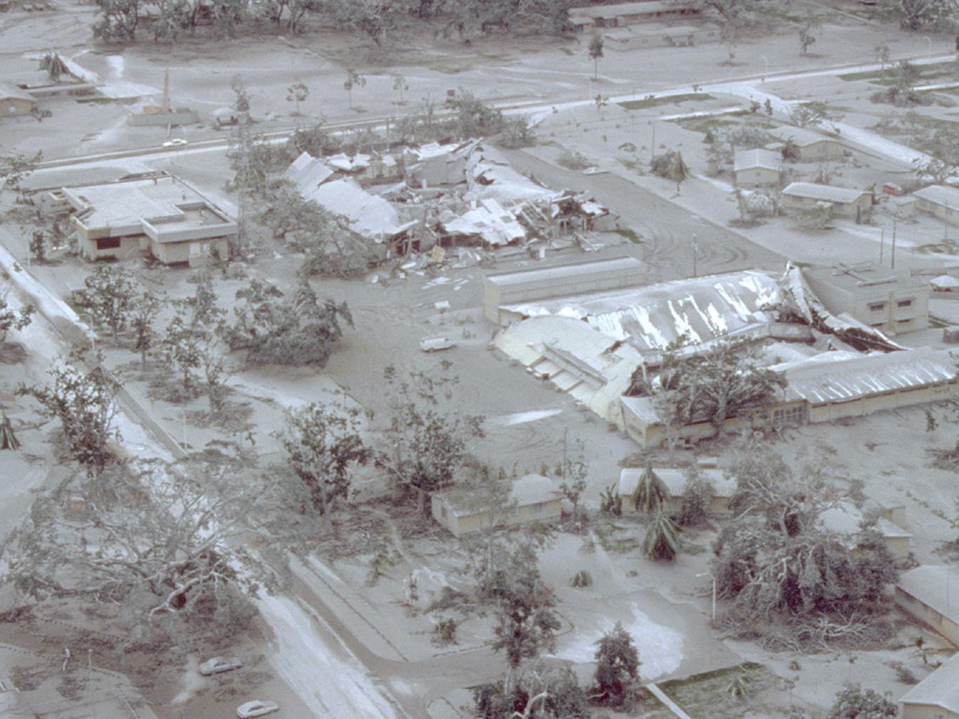
Pinatuboash covered clark air base. Aerial view of part of Clark Air Base on Luzon Island in the Philippines showing buildings and vegetation damaged by tephra ash fall of June Geological Survey Photograph taken on June by Willie Scott wr usgs gov html Image resized PDUSGov Aerial photographs of the Philippines eruption of