
Related Images


Download:
| Tiny | 190x128 | View | Download |
| Small | 381x256 | View | Download |
| Medium | 763x512 | View | Download |
| Large | 1527x1024 | View | Download |
| Original | 4000x2682 | View | Download |
This image was acquired from
wikimedia. It was marked as Public Domain or CC0 and is free to use. To verify, go to the source and check the information there.
Looking for more info about this image?
Try a Google Reverse Image Search for it.
Try a Google Reverse Image Search for it.
Keywords from Image Description:
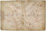
PinelliWalckenaer Atlas p. . The third sheet of the sevensheet PinelliWalckenaer Atlas set of Italian portolan chart depicting the west Mediterranean and north Atlantic coast including the British Isles it is oriented with West on top Dated although in reality possibly made little later and with additions from Ink and tempera on


