
Related Images


Download:
| Tiny | 152x128 | View | Download |
| Small | 305x256 | View | Download |
| Medium | 611x512 | View | Download |
| Large | 1222x1024 | View | Download |
| Original png | 1279x1071 | View | Download |
| Original as jpg | 1279x1071 | View | Download |
This image was acquired from
wikimedia. It was marked as Public Domain or CC0 and is free to use. To verify, go to the source and check the information there.
Looking for more info about this image?
Try a Google Reverse Image Search for it.
Try a Google Reverse Image Search for it.
Keywords from Image Description:
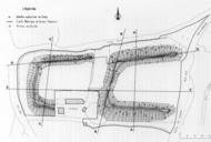
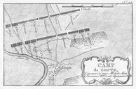
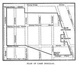
Plan of Camp Douglas . Map Dotted lines show streets located in Andreas Alfred Theodore Published in org page PDold map date Chicago warped print date Internet Archive accession number other versions Camp Douglas Old maps of Chicago