
Related Images


Download:
| Tiny | 191x128 | View | Download |
| Small | 382x256 | View | Download |
| Medium | 764x512 | View | Download |
| Large | 1528x1024 | View | Download |
| Original | 4163x2789 | View | Download |
This image was acquired from
wikimedia. It was marked as Public Domain or CC0 and is free to use. To verify, go to the source and check the information there.
Looking for more info about this image?
Try a Google Reverse Image Search for it.
Try a Google Reverse Image Search for it.
Keywords from Image Description:
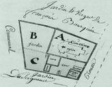
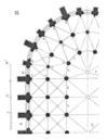
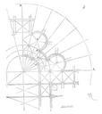
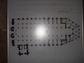
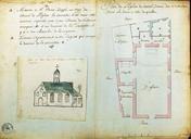
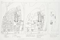
Plan du quartier de NotreDame . Artwork Aerial plans of the area around NotreDame Cathedral Three maps in order from left to right show the area in and On the overlay the same area is shown in lithograph cm Institution Brown University Library object history exhibition history credit line Published in Theodor Josef Hubert