Related Images


Download:
| Tiny | 141x128 | View | Download |
| Small | 283x256 | View | Download |
| Medium | 567x512 | View | Download |
| Large | 1135x1024 | View | Download |
| Original | 4512x4068 | View | Download |
This image was acquired from
wikimedia. It was marked as Public Domain or CC0 and is free to use. To verify, go to the source and check the information there.
Looking for more info about this image?
Try a Google Reverse Image Search for it.
Try a Google Reverse Image Search for it.
Keywords from Image Description:
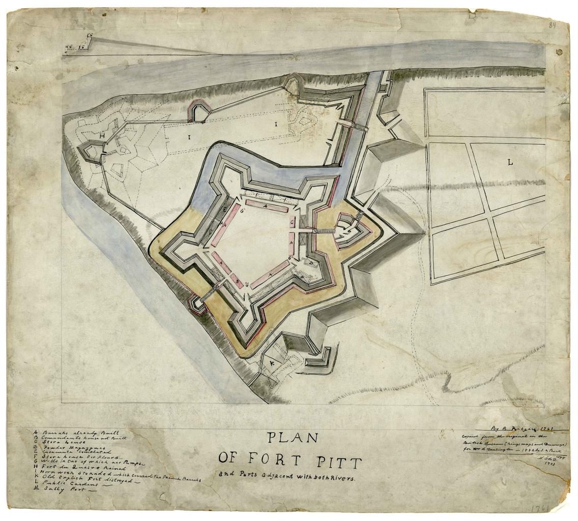
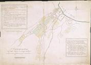
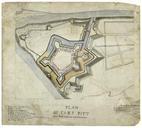
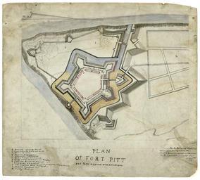
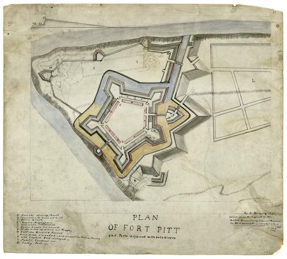
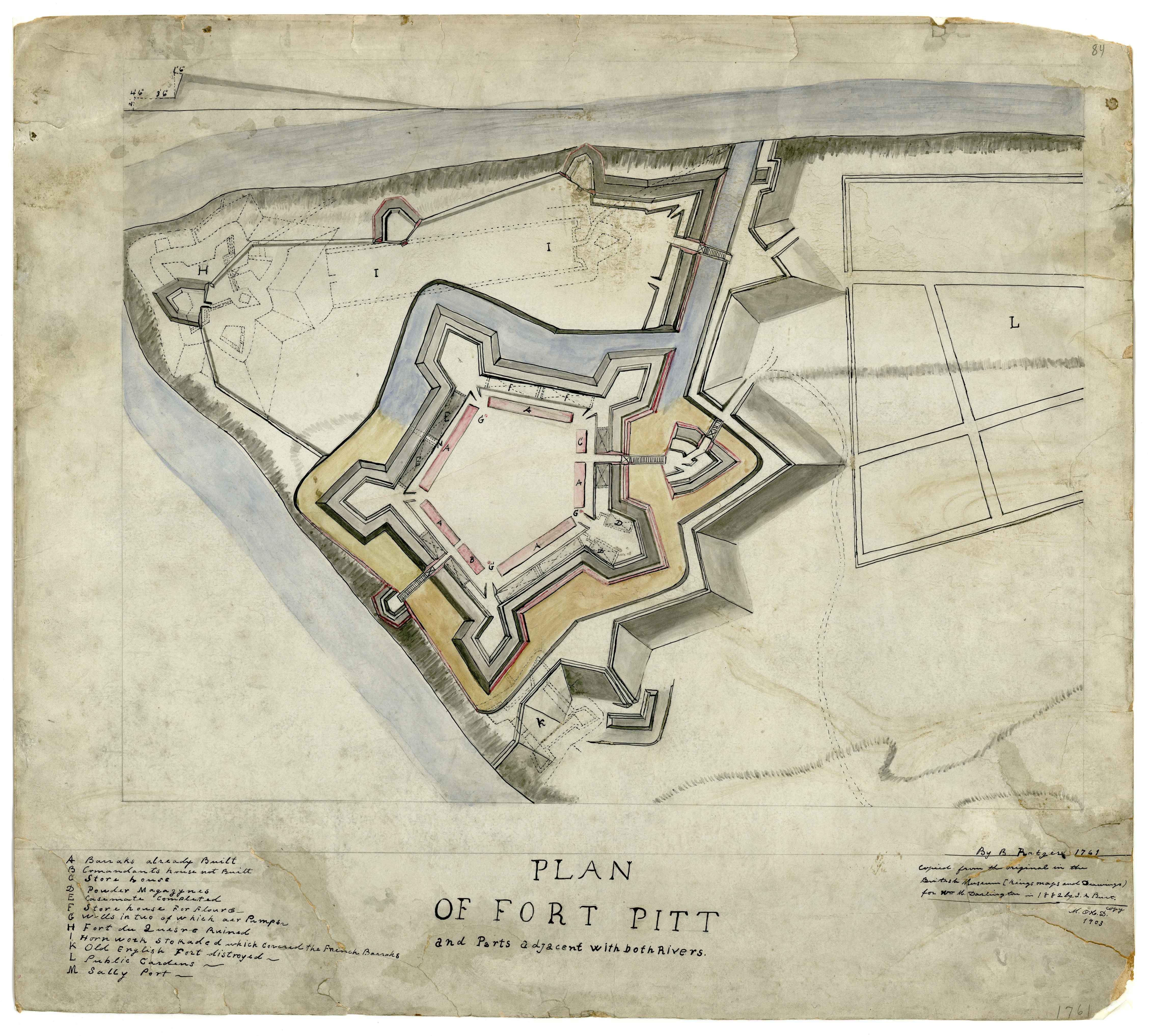
Plan of Fort Pitt . Plan of Fort Pitt and parts adjacent with both rivers Manuscript Map Copied from the orginial in the British Library Kings' maps and drawings for Wm Darlington by Burt O'H copy Also showing in dotted line the earlier French Fort Duquesne br Subjects Fort Pitt Pa Maps Manuscript Fort Duquesne Pa Maps Manuscript