
Related Images


Download:
| Tiny | 113x128 | View | Download |
| Small | 226x256 | View | Download |
| Medium | 452x512 | View | Download |
| Original | 600x679 | View | Download |
This image was acquired from
wikimedia. It was marked as Public Domain or CC0 and is free to use. To verify, go to the source and check the information there.
Looking for more info about this image?
Try a Google Reverse Image Search for it.
Try a Google Reverse Image Search for it.
Keywords from Image Description:
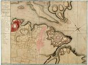
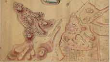
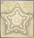
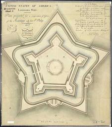
Plan ft st philip. Plan Projected for Cooperation of Defense of the Mississippi with Ft St Philip Drawn by cartographer and draftsman Guillaume Tell Poussin Ink and wash on paper This planned fort to work in cooperation with the existing colonial era Fort St Phillip on the East Bank of the Mississippi River in what is now Plaquemines